Smoothing the play-space land and sealing the 10 km island's vale
A lookout's way up is a path now, the Saddle's walls lost their panels, and the 10 km island passes both of its own checks for the first time.
The play-space land I laid on the generated islands had four loose ends, and I had them fixed in one go. A ridge lookout’s way up is a narrow path instead of a flat slab. The Saddle’s walls no longer look like rows of vertical panels. The 10 km island now passes its own two checks, the East Door and the Tower’s vale, which it failed even before I added features. The fourth item, the 10 km island’s tests, moved but isn’t done.
Why did the Saddle’s walls look like panels?
I asked what was left on this work and answered “Do 1-4”, so all four items went in one pass. The Saddle is a valley the generator cuts through a ridge, and its capped sides still showed rows of vertical panels in the game. I measured three causes on the 1 m terrain export.
The first was a one-cell step at the foot of the wall. The floor wore about 30 m below its set height, but the held wall’s foot stayed at that height, and the step was the panel. The held apron now carries on down into the floor at 33 degrees, to 0.3 of the valley’s half width. That part isn’t held, so erosion can still wear it.
The second was a kink in the side cap. The slope jumped from 7 to 40 degrees at 1.1 half widths, and the kink beaded along the diagonal of the grid. The cap now bends over 0.4 of the half width.
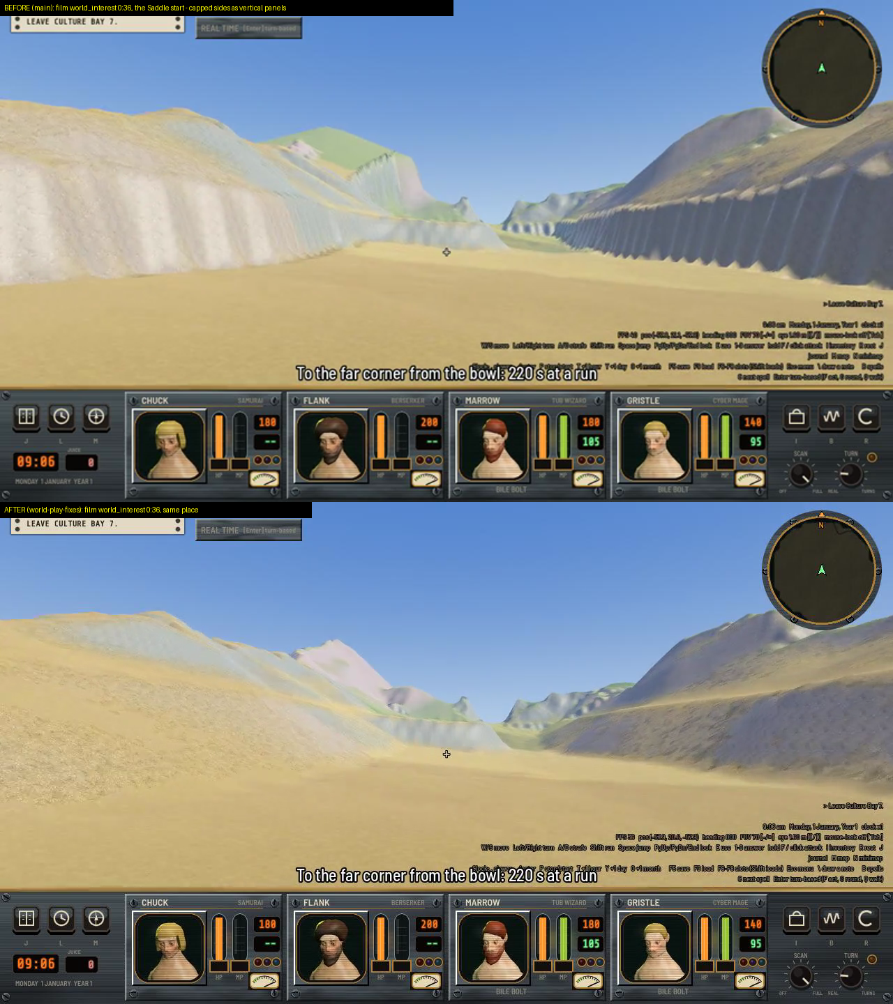
The Saddle’s start in the game, before (top) and after (bottom). The capped sides were rows of vertical panels and are now smooth slopes.
Why did the West Ridge have bands?
The third cause was the West Ridge’s bands. On a face at its angle of rest, each row is set by its own foot, so the rows are independent chains and nothing makes them agree. I tried jittering the routing first. It did nothing and I reverted it. Two of my own guesses, weak rock on the floor and holding the side, were not the cause either.
What worked is a new step in the erosion, erosion.even_faces(). On unheld cells steeper than 26 degrees it smooths the height along the contour only, never down it. That’s 4 passes with a weight of 0.5, then the angle-of-rest relax again. It runs for every island, not just this one.
Making a lookout’s way up a path
The way up to a ridge lookout was a flat wedge hundreds of meters across, with straight edges. The cause was that the pad’s 24 degree shoulder cone was carried over the whole window around the route, the route’s bounding box plus 100 m, and a rectangle of fill has straight edges.
Now it fills a strip along the route. The way up is a path 6 m wide. Its shoulders take the fill into the slope at 35 degrees at most, tapering over 4 m plus 1.5 times the fill divided by tan 35. Easy ground, meaning slope under 10 degrees, barely moved, 58.42% to 58.44%.
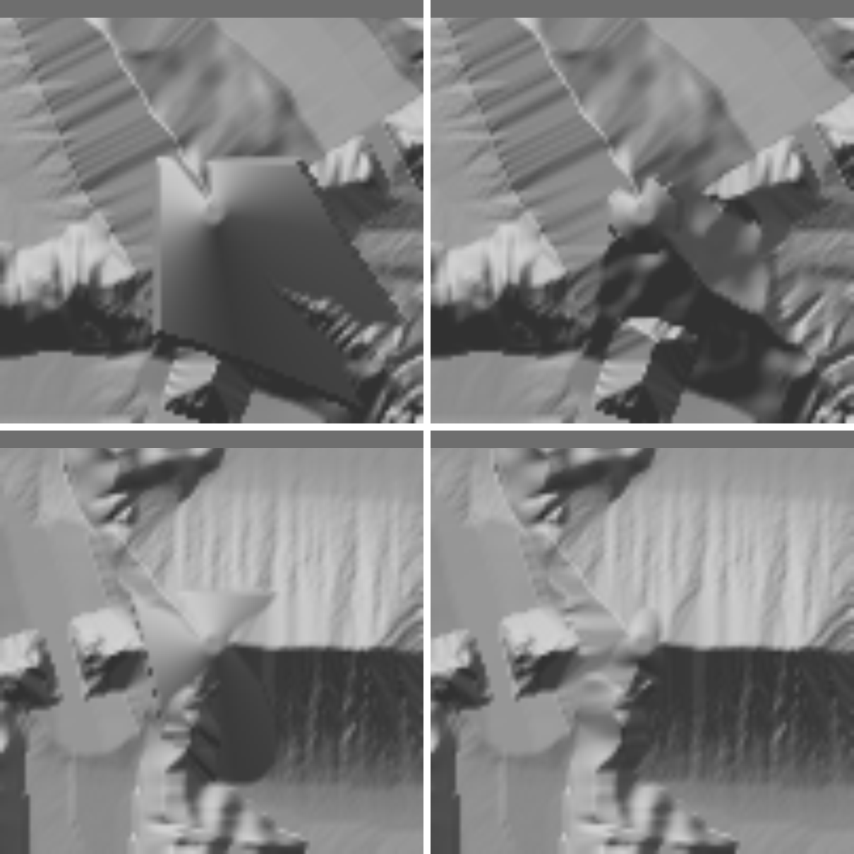
Hillshade of two lookout ways up on the 4 km island, before (left) and after (right). The flat wedges are now narrow paths.
Why did the Tower’s vale leak?
On the 10 km island two checks had failed since before the features, “the East Door: a way over on foot” and “The Tower’s vale is sealed”. Both pass now, on the plain island and the featured one. I found four causes, one after another, with a breadth-first search out of the vale with its gates shut.
- The East Door’s end was in the gulf. A valley pass now ends 160 m short of where its line meets the sea.
- The rim bar stood 20 m over the floor and 100 m over the gulf side. A pass gate now gets a level sill and held 18 degree ramps down every side.
- The scarp’s smoothstep ran on a distance warped by noise, and where the noise stretched it the face lay back into a ramp. It now runs on meters from the floor’s edge.
- The actual leak was the Shank’s north ridge, which was held, and its held ramp came down inside the vale’s crest and was walkable. Peaks are no longer held where that ridge would be inside a sealed crest.
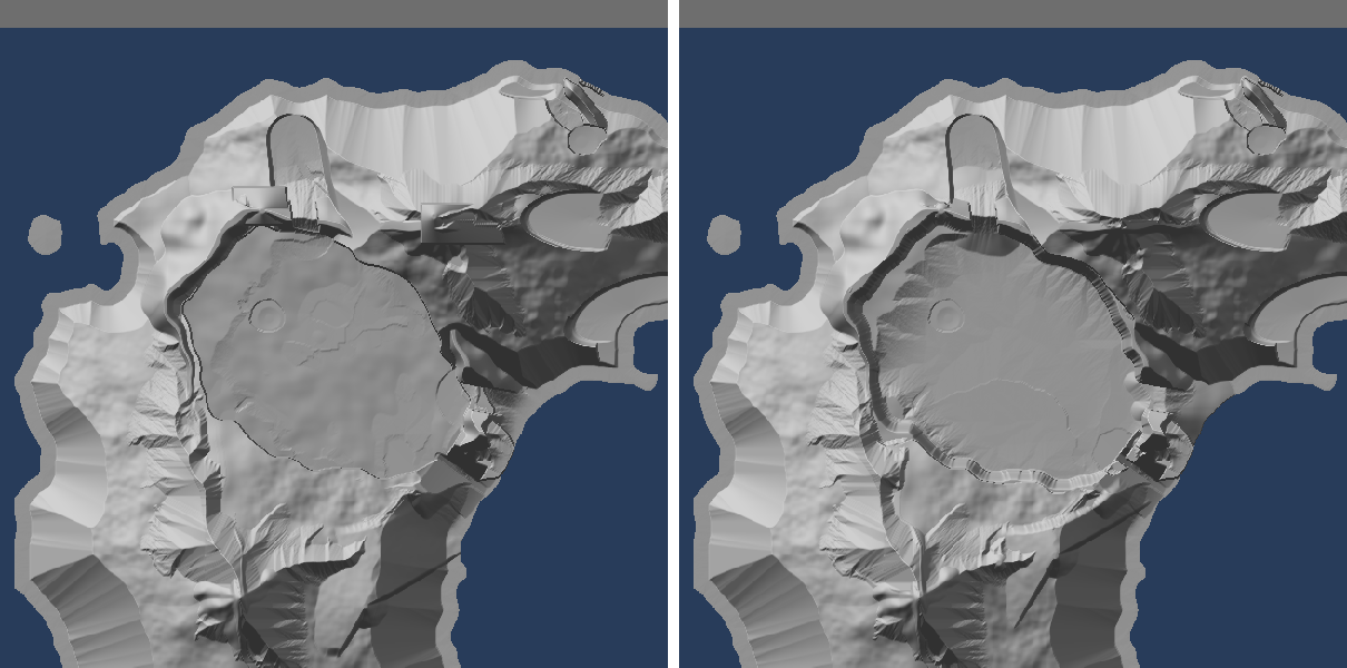
Hillshade of the 10 km island’s central vale and its rim, before (left) and after (right).
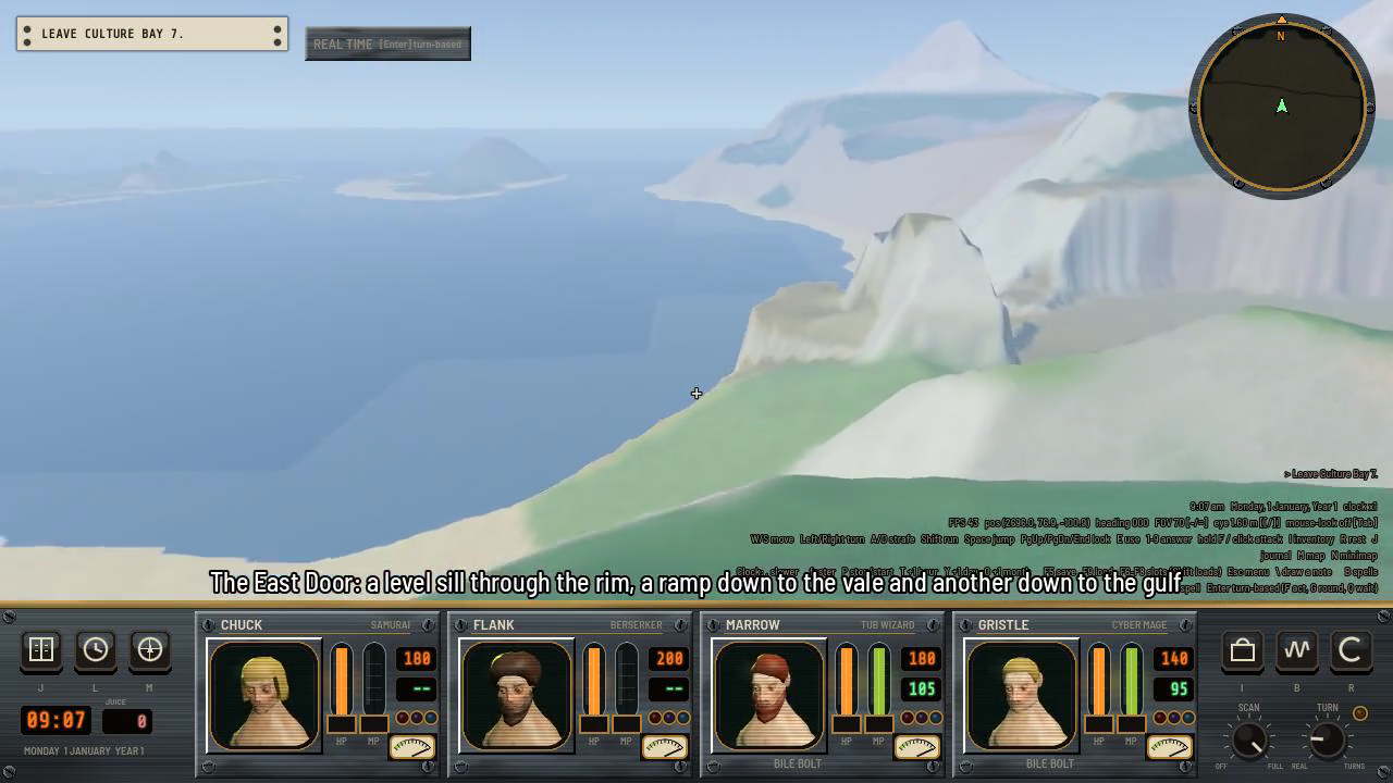
The East Door in the game, looking toward the gulf: a level sill through the rim, a ramp down to the vale and another down to the gulf.
The fixes moved the plain island too, because they are generator-wide. Its easy ground went from 47.22% to 46.54%.
What was wrong with the stranded pockets?
The 10 km island still passes 13 of 21 tests, so this item stays open, but I found out what the “stranded pockets” were. Each cluster of forms leaves out ground around its first stack when it counts walkable land, so the other members’ crowns counted as cut off. Each member is now left out by its own height. The features cut off 1.3 ha, 0.028% of the land.
The drop in walkable ground reached, 94.0% to 93.4%, is mostly the denominator. The forms, knolls and lakes make about 16,000 reached cells steep, and the Plug, which nothing can walk to, keeps about 43,500 cells in the total.
A new lookout key, crest_m, sets how far over the local mean a crest cell has to stand. The default stays at 4 and the 10 km island uses 15. Candidate sites went from 22 to 499, lookouts from 4 to 9, vantage points from 9 to 15, and P2 and P3 rose to 0.61 and 0.60. Most of those 499 sites don’t help, though. 415 see under 28% of the land within 3 km and 27 need more than 30 m of fill. I also tried knolls closer together, 500 m instead of 700 m. That was worse, 12 of 21 and broken chokes, so I put it back.
The featured island’s easy ground is 43.38% and my limit works out to 41.54%, so there’s about 1.6 points of room left. The first vantage test, the long stretch without a beat, one summit and the single valley are out of reach inside that room.
Also done
- The generator tests pass, 55 of 55, with the slow 10 km pair included.
- Valley passes are now listed as places in the export, like “the East Door”.